Boot Match New Zealand
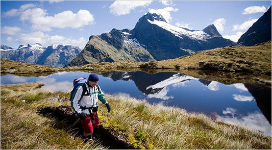
Milford Track
LOCATION: Fiordland National Park, South Island DISTANCE: 53.5km ALTITUDE CHANGE: SHORT DESCRIPTION OF THE HIKE: The Milford track is widely known tramping route in NZ. It is classified as a...
Milford Track
LOCATION: Fiordland National Park, South Island DISTANCE: 53.5km ALTITUDE CHANGE: SHORT DESCRIPTION OF THE HIKE: The Milford track is widely known tramping route in NZ. It is classified as a...
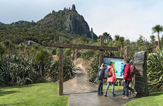
Mount Manaia
LOCATION: Taurikura Bay, Whangarei Heads DISTANCE: 3.5km round trip ALTITUDE CHANGE: SHORT DESCRIPTION OF THE HIKE: Mount Manaia is one of a cluster of majestic, jagged, bush-covered hills, the remnants...
Mount Manaia
LOCATION: Taurikura Bay, Whangarei Heads DISTANCE: 3.5km round trip ALTITUDE CHANGE: SHORT DESCRIPTION OF THE HIKE: Mount Manaia is one of a cluster of majestic, jagged, bush-covered hills, the remnants...
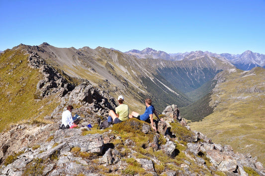
St. Arnaud Range Track
LOCATION: Nelson, Northern end South Island DISTANCE: 6km ALTITUDE CHANGE: 1,080m SHORT DESCRIPTION OF THE HIKE: This walk climbs steadily through the beach forest to a height of over 1650 metres. Above...
St. Arnaud Range Track
LOCATION: Nelson, Northern end South Island DISTANCE: 6km ALTITUDE CHANGE: 1,080m SHORT DESCRIPTION OF THE HIKE: This walk climbs steadily through the beach forest to a height of over 1650 metres. Above...
Mt. Tuhua Track
LOCATION: Lake Kaniere Scenic Reserve in the West Coast Region DISTANCE: 6.86km ALTITUDE CHANGE: Total ascent of 941.29m Maximum elevation of 1,090.85m SHORT DESCRIPTION OF THE HIKE: The track begins...
Mt. Tuhua Track
LOCATION: Lake Kaniere Scenic Reserve in the West Coast Region DISTANCE: 6.86km ALTITUDE CHANGE: Total ascent of 941.29m Maximum elevation of 1,090.85m SHORT DESCRIPTION OF THE HIKE: The track begins...
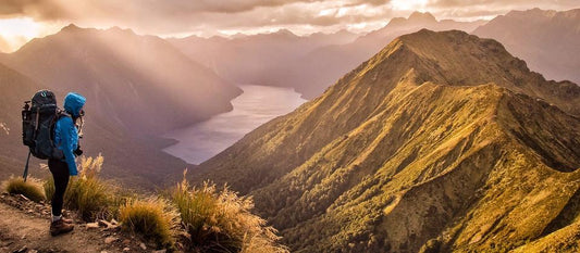
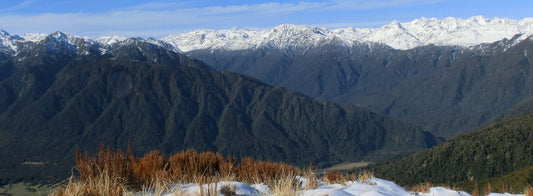
Kepler Track, Mt. Luxmore
LOCATION: Fiordland National Park, Lake Te Anua area, Southland DISTANCE: 13.8 km / 8-10 hrs return ALTITUDE CHANGE: 4829 ft / 1472 m SHORT DESCRIPTION OF THE HIKE: Mt. Luxmore...
Kepler Track, Mt. Luxmore
LOCATION: Fiordland National Park, Lake Te Anua area, Southland DISTANCE: 13.8 km / 8-10 hrs return ALTITUDE CHANGE: 4829 ft / 1472 m SHORT DESCRIPTION OF THE HIKE: Mt. Luxmore...
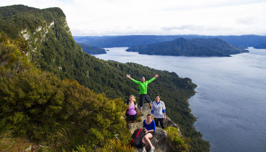
Lake Waikaremoana Track
LOCATION: Te Urewera on the eastern side of the North Island DISTANCE: 46km (one way) / 3-4 days ALTITUDE CHANGE: 566m SHORT DESCRIPTION OF THE HIKE: This track is a...
Lake Waikaremoana Track
LOCATION: Te Urewera on the eastern side of the North Island DISTANCE: 46km (one way) / 3-4 days ALTITUDE CHANGE: 566m SHORT DESCRIPTION OF THE HIKE: This track is a...